I have spent many years working with mobile application development tools. Each of the vendors I have known speak about the simplicity and speed of using their tools to develop and implement mobile applications. It is, for the most part, marketing speak.
Developing a mobile application is as simple as the database schema of the business application in which it will be integrated. If it is a simple data collection form that can be integrated with a simple spreadsheet or database, then it is fairly easy and will usually take days or a few weeks to develop. However, if the user wants a mobile version of their ERP, then I hope they have a few months and a significant budget. The point is, most mobile applications that synchronize with back-office enterprise database applications are not easy and simple and this is a problem for companies that need to inspect a wide variety of things.
I have witnessed over and over the challenges an inspection company has with mobile applications that run on handheld computers. The applications take longer to develop and cost more than the inspection task or project justifies. As a result, the inspection company continues to do it by hand. In another scenario, one inspection project may justify the time and expense of developing a mobile inspection application, but the next project does not. As a result, the inspection services company continues to use paper inspection forms on the majority of their projects. That is the economic reality, at least until now.
Recently I read an article called "
Kenaz and Touch Inspect:
Must-Have Products for the Warfighter" written by
Don Jewell. Jewel writes articles for GPS World focused on Defense and the military. He has spent more than thirty years in the Unites States Air Force, where he was involved with GPS systems from their inception, either as a test system evaluator or user. He served as a Commander at
Schriever AFB, the home of GPS, and retired as the deputy chief scientist at Air Force Space Command.
In Jewell's article he speaks of a mobile solution called Touch Inspect by
Mobile Epiphany. It is essentially a computerized,
geospatially aware, data-collection application with an amazing user interface. "The user interface matters to our
warfighters!"
Jewells writes, "because one of the biggest complaints from our
warfighters concerning military user equipment (
MUE) such as the Precision Lightweight GPS Receiver (
PLGR) and the Defense Advanced GPS Receiver (
DAGR) is the user interface."
Mobile applications for the military need to be geospatially aware. I wrote an article called
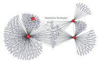
Network-Centric Mobile Field Force Automation that explores this requirement in detail from both a military and commercial perspective.
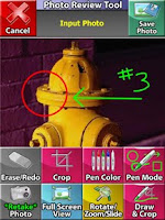
Touch Inspect is unique. It focuses on geospatially-aware inspections and provides a powerful pre-built platform in which custom mobile inspection applications can be developed in just hours. It is unique in that no coding or programming is required and the solution is designed by a company that has a deep history in the electronic games industry. This is quickly apparent when you see the intense graphics and sophisticated features that I have never seen before in a Windows Mobile application.
Jewell writes, "Touch Inspect allows you to build databases on the fly for inspecting things, and I do mean just about anything. But more than that, it is a flexible, user configurable database system that can be adapted for so many uses that are critical to our warfighters and first responders."
Jewell sees applications for this software in almost every aspect of a warfighter’s day, starting with running the various checklists they need to run for weapons, radios, vehicles, and GPS devices. With GPS devices and GIS mapping information right on the device (in other words, you don’t need an Internet connection to see your geospatial maps like you would using something like Google Maps), this new software really shines because it incorporates the warfighter’s current GPS position and time — or the asset’s GPS position — into every database entry, with photos if necessary. And this system uses the topographical maps or aerial images you want it to use, not just simple street maps. Plus, when the computer is once again in Internet, LAN, or WLAN range, it automatically updates the server at HQ and downloads new information automatically without any user interaction.
I recently wrote an
article about the use of rugged handheld computers and mobile inspection applications following the devastating fires that killed 173 people last year in Australia. In this case the police and emergency responders had an immediate need for a mobile inspection application that was
geospatically aware. This immediate need for a custom mobile inspection application could not be solved by taking weeks and months to develop a mobile application. They needed it now! Touch Inspect has all the appearances of solving requirements for near-real-time dynamic and custom mobile inspection applications.


