Showing posts with label location based services. Show all posts

Location Based Services and RFID Help Hospitals Save Money

The words location based services (LBS) immediately brings to mind mobile marketing apps and other location based sales and marketing services based upon GPS coordinates.  If we have an enterprise IT perspective we may think of fleet management, asset management and equipment tracking.  The technologies and strategies behind these technologies, however, are not limited to rugged outdoor, blue collar environments.  They have now also moved into sterile indoor environments.  Let's review a few of these use cases documented by Caleb Benedict, Research Analyst, GIS/IoT.

The use of LBS (location based services) in the healthcare industry is growing rapidly. It is being used to save time, money, and reduce liabilities. Earlier this week an article was published by Pharmabiz.com that described how Tyco Security is providing Indian Hospitals with RFID services to track patients, medical equipment and pharmaceuticals (http://bit.ly/PAIJvP).  Along with knowing patient locations, these solutions allow hospitals to track and maintain security over expensive equipment, and to closely monitor prescription drugs to limit dangerous mistakes.

A recent report by Research and Markets predicts the healthcare RFID market will grow at a CAGR of 35 percent through 2017. As this forecast demonstrates, RFID technology continues to gain traction in the healthcare industry proving that it has moved beyond its roots tracking cargo containers and freight (http://bit.ly/PAIJvP).

LBS technologies are also on the rise.  Markets and Markets reports that the location based services market will grow at a CAGR of 25 percent annually through 2019 and the market will be valued at $39 billion. They also report that the largest portion of LBS growth will come from the healthcare asset management sector. LBS solutions help hospitals monitor patients locations and track ambulances as they respond to emergencies and deliver patients (http://bit.ly/1l7gV10).

It is our analysis, based on a review of publicly available data, that the healthcare industry will continue to adopt these technologies as they are proving to save money, reduce loss and limit liabilities. These solutions, along with GIS applications in healthcare, illustrate the huge potential the industry has in applying location and tracking technologies in everyday hospital operations.
************************************************************************
Kevin Benedict
Senior Analyst, Digital Transformation, EBA, Center for the Future of Work Cognizant
View my profile on LinkedIn
Learn about mobile strategies at MobileEnterpriseStrategies.com
Follow me on Twitter @krbenedict
Join the Linkedin Group Strategic Enterprise Mobility
Join the Google+ Community Mobile Enterprise Strategies
Recommended Strategy Book Code Halos
Recommended iPad App Code Halos for iPads

***Full Disclosure: These are my personal opinions. No company is silly enough to claim them. I am a mobility and digital transformation analyst, consultant and writer. I work with and have worked with many of the companies mentioned in my articles.

Increasing Productivity and Getting Strategic with Geospatial Information Systems

By Caleb Benedict, Research Analyst, GIS/IoT


Companies in many different industries are realizing applications of GIS (geospatial information systems) can provide competitive and strategic advantages, productivity increases and efficiencies in operations. GIS, when combined with mobile devices like smartphones, tablets, laptops and other handheld devices allow organizations to use GPS sensors, digital maps and editing software in order to view, document and analyze all kinds of things in new and innovative ways.

Once you represent your environment, location and processes digitally, you can build all kinds of analytics, algorithms and processes to take advantage of this data.

Even in simple scenarios interesting analytics and processes can be done. Knowing the location of a mobile asset at a date and time is helpful.  If it is moving, knowing how fast it is going and estimating the time of arrival is useful.  Knowing where a mobile worker is located and their skills, qualifications and job status enables you to plan their next job dynamically.  All of these items start with knowing their location.

Some additional examples of GIS applications are:

  • Tracking fleets of vehicles with dynamic maps to estimate time of arrival and ensure safety and compliance
  • Monitoring the location of employees to ensure safety and optimized utilization
  • Mapping underground utility lines for sewer, cable, electricity, to provide safety and optimized construction and maintenance activities
  • Mapping construction progress to ensure deadlines and schedules are met

A decade ago, GIS technology required expensive hardware and software to support it. Today, however, relatively inexpensive iPads and smartphones can be used with Google Earth and other GIS databases.

ESRI, the largest GIS software developer, allows workers to use tablets and smartphones to input data and create maps.  ArcPad, ESRI’s application for mobile devices, allows field workers to collect and input data on their mobile device and sync that data with their desktop programs such as ArcMap or ArcGIS. This technology is relatively new and is increasingly important for companies of all kinds.

Examples of GIS in action:

Columbia County, Georgia is using field GIS applications to map underground broadband Internet lines in order to have accurate locations of their utility system. Using field workers equipped with GPS devices and GIS software the county was able to quickly collect this data with the highest level of accuracy. (http://bit.ly/1hy7OxU)

Australian mining companies are using GIS to increase productivity and safety for their operations. Using GIS the mining companies have been able to track supply shipments by outfitting truck drivers with iPads that relay their locations to other iPads with the same real-time, dynamic map of mining sites. In addition companies have been tracking employees to ensure their safety when working in dangerous environments. (http://bit.ly/Pr9jrr)

The North Charleston Sewer District in South Carolina is using GIS to track construction progress and asset locations. This has allowed project managers to supervise the construction progress with more detail and to have better accountability on county vehicle usage. (http://bit.ly/1mWdQOd)

*************************************************************
Kevin Benedict
Senior Analyst, Digital Transformation Cognizant
View my profile on LinkedIn
Learn about mobile strategies at MobileEnterpriseStrategies.com
Follow me on Twitter @krbenedict
Join the Linkedin Group Strategic Enterprise Mobility
Join the Google+ Community Mobile Enterprise Strategies

***Full Disclosure: These are my personal opinions. No company is silly enough to claim them. I am a mobility and digital transformation analyst, consultant and writer. I work with and have worked with many of the companies mentioned in my articles.

Notes on the Location Based Services Market

By Caleb Benedict, Research Analyst, GIS/IoT, Netcentric Strategies


IBM has recently invested $1.1 billion USD into Location Based Services (LBS) and Application Programming Interface (APIs).  The investment was in the development of BlueMix, a cloud-based service, that when combined with Pitney Bowes' API programs, allow businesses to collect data on consumers based on their location and geography.

GPS enabled smartphones are introducing a whole new precision to LBS.  No longer are companies needing to triangulate between cellular towers to get a general location, when GPS data can identify the exact business location.  This enables location, business type, company name and more to be added to time and date.  Patterns of life can start to be recognized and marketing and promotional campaigns created based upon these findings.

In addition to smartphones, the IoT (Internet of Things) enables equipment, supplies, materials, vehicles, trailers etc., to all be located on a map in real-time.  We will talk more about this in another article.

It is my analysis that investments into business intelligence and meaning-making based on LBS is a requirement going forward for many industries. When user locations are recorded and studied by a cloud-based business intelligence system and strategies adjusted based upon the meaning-making of this data, then you can start delivering competitive advantages.

Benefits of Location-Based Services for companies…
·      Companies are able to study consumer habits based on geography
·      Companies can adjust business practices based on consumer locations
·      Marketers can advertise based on precise locations
·      Consumers can participate in location-based coupons and daily deals
           
Some additional notes from my recent research on the LBS market:

Facebook and Google dominate the market share of LBS - controlling 46% according to a recent Berg Insight report. As long as Facebook and Google continue to purchase companies like Instagram they will continue to dominate.

According to the same report the LBS market will grow at a 16% CAGR through 2018 and Facebook and Google will continue to control roughly half the market share throughout those years.

Heineken has been using Foursquare to allow beer drinkers to check-in when purchasing Heineken beverages. This mobile campaign is aimed at engaging consumers and building brand loyalty by offering the chance to win sports memorabilia as incentives for checking-in when drinking Heineken products.

Facebook’s Instagram is threatening the future of Foursquare by experimenting with a new, in-house location-based check-in function in place of Foursequare’s service.  Foursquare’s major clients are currently Flicker, Vine, Instagram, Pinterest, and Path. If Instagram and their 200 million users switch to an in-house check-in service and replace Foursquare this would dramatically reduce Foursquare’s market share in the location-services market.


*************************************************************
Kevin Benedict
Senior Analyst, Digital Transformation Cognizant
View my profile on LinkedIn
Learn about mobile strategies at MobileEnterpriseStrategies.com
Follow me on Twitter @krbenedict
Join the Linkedin Group Strategic Enterprise Mobility
Join the Google+ Community Mobile Enterprise Strategies

***Full Disclosure: These are my personal opinions. No company is silly enough to claim them. I am a mobility and digital transformation analyst, consultant and writer. I work with and have worked with many of the companies mentioned in my articles.

The Growing Importance of GIS to Organizations, Industries and Municipalities in 2014

By Caleb Benedict, Research and GIS Analyst

During the past decade GIS (Geospatial Information Systems) has grown from a term representing simple navigational devices and GPS handsets to something much more complex and useful. In the past ten years the GIS market has steadily grown in numbers of applications, use cases, industry adoption and users. Newly published forecasts for the GIS market predict that the GIS industry will grow at an estimated 8% CAGR through 2016.

It is my analysis that GIS applications in both public and private sectors are growing faster than 8%. By researching job announcements on city employment pages, it is obvious there is an increasing demand for GIS analysts, specialists, and technicians.

This growth is due to advancements in GIS technology and the realization that GIS applications are important tools for just about every municipal government, engineering firms, industry and organizations with remote and mobile job sites, projects, assets and workforces today. Digital mapping and remote sensing (the use of satellite imagery outfitted with sensors) is delivering increased safety and savings in the form of time, money and resources.

GIS in the news…

The U.S. government increases the U.S. Geological Survey budget by $41 million to $1.1 billion total. (http://www.gisuser.com/content/view/32343/2/)

Peoria, Illinois is using GIS and LIDAR imagery to collect information on city streets in order to understand street conditions and plan for infrastructure improvements. (http://peoriapublicradio.org/post/peoria-survey-streets)

GIS planning has resulted in a 30% decrease in traffic related deaths in Abu Duabi after GIS planning improved traffic lights and street management. (http://gulfnews.com/news/gulf/uae/abu-dhabi-road-accident-deaths-drop-30-in-five-years-1.1310328)


***Full Disclosure: These are my personal opinions. No company is silly enough to claim them. I am a mobility and digital transformation analyst, consultant and writer. I work with and have worked with many of the companies mentioned in my articles.

Geo-fencing, GPS Tracking and SAP Enterprise Mobility

Geo-fencing
Have you thought much about geo-fencing and its value to your business?  To me, it is a very interesting feature of most GPS tracking systems and a useful feature when you want to track locations of resources, materials, equipment and other assets.  Here is how geo-fencing works - when a location-aware device (GPS tracking enabled) enters or exits a particular geographic area that is configured (in the GPS tracking system) with a geo-fence boundary, the device sends or receives an alert/notification.  This notification can be the trigger for any number of clever business processes that you can design.

How is a geo-fence useful?  You can view, in real-time, when vehicles, equipment, materials and mobile devices enter or exit a job site, depots, routes or any other geographically defined area.  You can see when a truck is arriving at a warehouse and route it to the first available warehouse dock.  You can let the job site manager know when materials are about to arrive so they can be prepared to receive it.  For security reasons, you can set geo-fences around job sites so any vehicle, machine or equipment leaving the job site after work hours sends you a notification.  This can be an effective anti-theft feature.

You can also use geo-fencing to notify customers when you are nearing their location.  Let's say that a service technician is dispatched to a customer's location.  When the service technician is estimated to be 15 minutes from the customer's site, a text message is automatically sent to the customer notifying them of the estimated time of arrival.  This certainly is an appreciated customer service interaction.

Another scenario is the arrival on your job site of a specialized piece of equipment.  When it is 1 mile from the job site, the site manager is notified so they can meet the driver and show them where the equipment needs to be off-loaded.

Another use of geo-fences is to identify all resources and assets within a particular area.  Let's say a service technician is dispatched for an emergency repair at a remote location.  It might be prudent to look for other maintenance or repair jobs that can be done at the same location while the service technician is there.

Some companies have service contracts to maintain and repair all customer equipment for a given period of time.  In these situations, the service organization tries to optimize their services and service visits in order to maximize profits.  I worked on a mobile project with a commercial HVAC company (heating, ventilation and air conditioning) in the UK that worked on these terms.  The first thing they did when they signed on a new customer is geo-tag all equipment that they agreed to service.  This enabled them to understand the exact location of all equipment under contract.  Once this was completed, they could geo-fence areas and know exactly how they could optimize service visits in particular areas.

There are an unlimited number of uses for geo-fencing.  I know SAP has a program in place to quickly determine the location of their employees in case of emergencies.  SAP wants to be able to support their employees in times of emergencies and they can set geo-fences around particular areas to quickly see who is there.  I don't believe they are using GPS tracking in these cases - I think they just have a way to see who is in a particular area based on schedules, home and office locations.

The military uses geo-fencing to organize their missions.  Weapons have defined effective ranges.  Aircraft have limited ranges based on fuel consumption.  Soldiers have travel limitations based upon available transportation.  Are they required to walk, drive or be flown in.  All of these tasks and resources have limits.  Understanding locations, resources, schedules and limitations enable commanders to effectively identify and organize missions based upon these variables and timing.  In my mobile strategy workshops I call these "optimized intersections."

*************************************************************
Kevin Benedict, Mobile Industry Analyst, Mobile Strategy Consultant and SAP Mentor Alumnus
Follow me on Twitter @krbenedict
Full Disclosure: I am an independent mobility analyst, consultant and blogger. I work with and have worked with many of the companies mentioned in my articles.

Enterprise Mobility the Next Wave - Six Super Trends

Mobile Innovations
Today, only 32% of 602 SAP customers surveyed by insiderRESEARCH (download full report here) have an enterprise wide mobile strategy in place.  That means there is still a lot of work and thinking to be done here, but today we are going to take a break from today's environment and look at tomorrows'.

For the past few months I have been pondering the next wave of technology innovations that will have major impacts on most IT environments.  As a result, here are the "SUPER" trends that I would recommend IT organizations start watching and studying.  These are also the technologies that I would like to hear SAP discuss at Sapphire this year.

  1. Enterprise Mobility, Part 2 - Customized, Context Aware, Pervasive and Predictive Content
  2. Geospatial and situational awareness about everything - 4 dimensional field services
  3. M2M (machine to machine, the Internet of Things) integrated into everything - Example Health Monitoring
  4. Augmented and Assisted Reality on mobile devices - Examples Navigation and Google Glasses
  5. Real-time and data-driven decision making - Think Big Data, Location Based Services and Real-Time Business Analytics
  6. Robotics and Artificial Intelligence

In addition to these six super trends, there needs to be taught new ways of thinking in a real-time, data-driven world.  Just like the military teaches soldiers land navigation, it will be equally important for the commercial sector to be taught how to navigate real-time data effectively.  In a world that provides massive volumes of raw data that will absolutely overwhelm a manager, there needs to be training on how to navigate directly to the important data that impacts the missions.

If we want to boil down these six super trends to their essence, it is real time communications between  sensors, machines, people, big data and analytics.

Do you agree, or are there other super trends that I have missed?


*************************************************************
Kevin Benedict, Independent Mobile Industry Analyst, Consultant and SAP Mentor Alumnus
Follow me on Twitter @krbenedict
Full Disclosure: I am an independent mobility analyst, consultant and blogger. I work with and have worked with many of the companies mentioned in my articles.

Mobile Expert Video Series: Centigon's Ryan Goodman

This is an interview with Centigon's CEO Ryan Goodman.  They are using Google Maps and business intelligence to offer some interesting mobile solutions for SAP users.

Don't forget to take the enterprise mobility survey at the top of this page!  It will help us all better understand today's market.


*************************************************************
Kevin Benedict, Independent Mobile and M2M Industry Analyst, SAP Mentor Volunteer
Follow me on Twitter @krbenedict
Full Disclosure: I am an independent mobility analyst, consultant and blogger. I work with and have worked with many of the companies mentioned in my articles.

Mobile Retail Applications a Transformational Trend

 I read an interesting article today in Bloomberg about mobile shopping and mobile retailing applications.  Here are a few excerpts.

  • Almost 60 percent of mobile consumers expect to use their phones to help with shopping plans and holiday celebrations this season, according to the Mobile Marketing Association.
  • Paul Jacobs, CEO of Qualcomm recently stated, “The phone is going to be the payment mechanism of the future.  You’ll probably just scan whatever thing it was that you’re buying. It will cause the checkout to happen. It will cause the security to happen, so that when you walk out of the door it won’t ring the bell.” 
  • About eight percent of consumers in the U.S. have bought something with a phone. That compares with 32 percent in Taiwan, which tops the list of major industrialized countries, according to IE Market Research Corp.  Finland was No. 1 in Europe, at 13 percent.

The article highlights the fact that Best Buy, Home Depot and Amazon.com all have mobile retailing applications now.  I have had many discussions with the mobile retailing experts at Smartsoft Mobile Solutions, and I find this market very interesting.  It combines the following:

Throwing Your Food Away and Mobile Applications

In Jonathan Bloom's new book American Wasteland he reports that the US produces about 591 billion pounds of food each year of which about 50 percent goes to waste somewhere along the food supply chain.  This includes unused restaurant food, food in the field and vegetables and fruits in the grocery store as examples.  Grocery stores throw away an estimated 30 million pounds of food each day.

Mobile Retailing and Location Aware Applications

The location based services market is forecast to reach $21 billion by 2015.  Location aware mobile applications can provide the potential for many businesses to reach mobile users at the right time and in the right place.  What does this mean?  It is 11:45 a.m. and you are thinking about lunch.  If an email or text message arrives to your smartphone with a coupon for your favorite sandwich at the restaurant just a block from your office, there is a very good chance that you will eat there.

Location Based Services and Mobile Retailing Applications

There is a fast growing segment of the mobile applications market that is rapidly being adopted by retailers.  Retailers and consumer packaged goods companies like Best Buy, Disney, Procter and Gamble, Starbucks, The Gap, American Eagle, Sports Authority and Macy's are all involved in various location based services projects. 

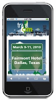
Movitas to Provide Mobile Marketing and Communication Services to TravelCom 2010


I know the folks at Movitas and they are developing some very interesting mobile solutions for location centric businesses such as hotels, resorts and conferences.

Collegeville, PA – February 10, 2010: Movitas, the leading mobile communication, marketing and commerce platform for the travel, conference and hospitality industry, has been selected to provide mobile marketing and mobile communication services for the U.S. Travel Association’s premier travel industry conference and trade show “TravelCom 2010” to be held March 9-11 at the Fairmont Hotel in Dallas, TX.

The TravelCom mobile platform, provided by Movitas, will provide information and offers during the show and allow attendees to interact with speakers and exhibitors in real-time, via any type of web-enabled mobile phone. The TravelCom mobile marketing and communications capabilities include an always up-to-date mobile website (featuring the show news of the day, session schedules, Fairmont Hotel floor plans, as well as speaker and exhibitor profiles), integrated social media to enable everyone to interact and experience the show via Twitter and Flickr feeds, and a text message system providing alerts, speaker updates and special offers.

As always, TravelCom covers the entire travel distribution and eCommerce food chain. However this year mobile media strategies are receiving more attention than ever before. For example, TravelCom will leverage mobile technology to allow attendees to influence session content during the show.

“With a stronger focus on online marketing, social media, mobile media and online commerce strategies, we decided not only to tell, but to show TravelCom attendees how mobile can become part of the travel industry’s business processes,” said Ben Isenberg, Chief Operating Officer at Vantage Strategy Consulting, producer of TravelCom. “Everyone involved in the show will get a first-hand look at the future of mobile business and Movitas’ approach to solving some of our industry’s challenges.”

About Movitas
Movitas is a leading mobile communication, marketing and commerce platform for location-centric businesses such as hotels, resorts and conferences. It provides a suite of solutions designed to drive revenue, improve the customer experience, manage mobile marketing campaigns, and deliver mobile business processes. Solutions include content management, messaging, commerce, logistics, workflow, and internet based administrative tools that can integrate into property management (PMS), central reservation (CRS) and point of sale (POS) systems. For more information visit: www.movitas.com. Also follow on Twitter at http://twitter.com/movitas.

About TravelCom
TravelCom is the only eCommerce conference designed by the travel industry for the travel industry. TravelCom elicits the most actionable, practical and current insights from the industry’s most senior thought leaders and speakers. Their expert knowledge offers insight and research into the entire travel distribution and eCommerce food chain; including distribution, strategy, marketing and technology tool sets. TravelCom is owned by the U.S. Travel Association and is being produced by Vantage Strategy. For more information visit www.travelcomexpo.org.

***************************************************
Author Kevin Benedict
Mobility Consultant, Wireless Industry Analyst and Web 2.0 Marketing Expert

http://www.netcentric-strategies.com/
www.linkedin.com/in/kevinbenedict
twitter: http://twitter.com/krbenedict
http://kevinbenedict.ulitzer.com/
http://mobileenterprisestrategies.blogspot.com/

***Full Disclosure: I am an independent mobility consultant and Web 2.0 marketing expert and as such I work with, and have worked with, many of the companies mentioned in my articles.
**************************************************

iPhone Mobile Audio Guides Created on the Street

Last week I was sitting in a soft leather chair in the corner of the Eagle, Idaho Starbucks Coffee Shop. Not so unusual, but this time I was recording the event on my iPhone using a free application called Woices.com. This application is the result of an entrepreneurial project out of Barcelona, Spain.

This application enabled me to record an audio guides using the "Memo" function of the iPhone, associate a digital photo, capture the GPS coordinates and add a description and title. All of these individual functions exist already on the iPhone, but Woices brings them all together in one clever application and enables you to upload them to a centralized service so others can search and find your audio guide.

When I first opened Woices, it searched on my GPS coordinates for any pre-existing audio guides that were within a certain distance of my location. If they exist, it lists them. In my case, I was the first user in Eagle, Idaho. Woices can turn any storyteller, traveller or history buff into a mobile reporter. I love it!!

The next steps I would like to see are the following:

1) Democratize history - let every person with an experience in a specific location, record it using text, digital photography and audio formats with a GPS coordinate, date and time stamp. It can be first romances, first driving ticket, childhood home or something big like a forest fire you witnessed as a child.

2) Set up a function that will revolutionize newspaper reporting. Let every person be a reporter. They can review the recorded history, experience or event and report on it. These can be picked up by local newspapers and reported under the title of "citizen" reporters.

These features would be intended to merge personal experiences, personal history, social networking and geospatial data together to form a democratic form of history, perhaps a wiki-history and/or wiki-reporting.

Think about it for a moment. How many of us have known people that had volumes of history in their memory, but it was lost with their passing? I would love to walk through a historic neighborhood, and have stories, history and experiences popping up on my iPhone application list as I walked from block to block listening.

What are your thoughts? Where can you see these kinds of features and services being useful in business?

I can see the benefit in big construction projects where experts can share thoughts, recommendations, warnings and insight as they tour the project. These captured thoughts would be associated with audio files, text files, GPS coordinates and digital photos. These recordings could then be accessed by others on the project.

I look forward to your comments!

***********************************************
Author Kevin Benedict
Independent Mobility Consultant, Wireless Industry Analyst and Marketing Consultant
www.linkedin.com/in/kevinbenedict
twitter: @krbenedict
http://kevinbenedict.ulitzer.com/
http://mobileenterprisestrategies.blogspot.com/
***********************************************

Mobile Applications, Location Based Services and Lifestyle Preferences

I love hiking. I enjoy gardening. I love mobile gadgets. I crave Thai food. I love drinking coffee in a comfortable chair and reading the New York Times. I would appreciate and use a mobile application that would connect my lifestyle preferences to a map and suggest locations conducive to my lifestyle.

I would like to arrive in a new city and open my mobile application and have it suggest great walking tours and hiking trails that were close to highly rated coffee shops, Thai restaurants, bookstores and public gardens. I would want to see these locations on a map with a suggested route. I would love to be shown several options all based on my preferences.

The application could also show me user comments and ratings of these locations, and overlay crime statistics of these geographic areas so I can weigh the risk of going there. Is the Thai food worth getting mugged?

I can see it now - you should be able to set different safety ratings. You can configure the mobile application to show just the safest locations based upon accident, crime and health inspection data, or you can live on the wild side.

I am looking for suggestions and recommendations if this mobile application already exists. If not, all you entrepreneurs should start working.

***********************************************
Author Kevin Benedict
Independent Mobility Consultant, Wireless Industry Analyst and Marketing Consultant
www.linkedin.com/in/kevinbenedict
twitter: @krbenedict
http://kevinbenedict.ulitzer.com/
http://mobileenterprisestrategies.blogspot.com/
***********************************************

Location Based Services and Mobile Device Customization

Many SMEs (small to medium sized enterprises) that use smartphones such as iPhones would benefit from the ability to add business information, alerts, tags and advice to a specific location on a map. Large enterprises can achieve these features by investing in business analytics, GIS solutions, route optimization applications, mobile data collection solutions and integrate them all with CRMs, but these enterprise solutions are often cost prohibitive for SMEs. They need these features all on a simple mobile application that is either connected to a web service or independent on the device.

Let's consider a few scenarios:
  • A taxi driver has found a very good place to pick-up riders. He/she wants to mark this location on a map and include other relevant information such as day of week, time of day and the reason this is a good location.
  • A house painting contractor driving through a neighborhood notices that it has a large number of houses that may need painting in the near future. The contractor pulls over, marks a map on his iPhone and enters the details.
  • A landscape company owner notices a new housing development is going in. He pulls over and marks his map and enters the details.
  • A neighborhood watch member notices ongoing suspicious activities and marks the location on his/her iPhone map and relevant details.
  • Citizens report potholes in the road to the appropriate government agencies. They mark the location on their maps and then call in the details or enter the data in a government sponsored website.
  • A parent enters the location of their children's friends' homes, by marking them on a map so they can quickly find them and know where they are located.

Any information that is location based and would help a person plan their business or personal life better would be useful. It would be beneficial if these applications were easily customizable so that individual users could quickly and easily edit them for their specific needs.

Can you think of other features that would be useful?
***********************************************
Author Kevin Benedict
Independent Mobility Consultant, Wireless Industry Analyst and Marketing Consultant
www.linkedin.com/in/kevinbenedict
twitter: @krbenedict
http://kevinbenedict.ulitzer.com/
http://mobileenterprisestrategies.blogspot.com/
***********************************************
Google and Mobile Phones - Analysis

"It is understandable that Google wants to be a serious player in mobile communications," writes Martin Peers in an article on December 15th, 2009 in the Wall Street Journal. However, he follows by saying, "It is unclear why it (Google) needs to sell mobile phones to dominate mobile search."

Lets discuss: Google Goggle allows you to take a picture of a landmark or building and then automatically combine the photo with the integrated GPS coordinates to conduct an automatic query that displays information about it. This convergence of technology, GPS radio, digital camera and wireless radio to connect to the Internet are all hardware components in the phone.

The GPS and digital camera components are mobile data collectors. The information collected is used to perform automated searches. These searches can bring up the details of the objects in the photos as well as other choices for food, hotels, shopping etc, near that location. The LBS (location based services) where local companies pay money to have their presence and products marketed is the profit center.

Google would also recognize value in knowing who owns the phone. As the manufacturer and vendor, they would have a good reason to know who owns the phone. They could then connect this information with what they know about you from your existing Google Accounts. They could combine what they already know about your browsing habits and interests in the virtual world with your travels, habits and interests in the physical.

I can fully understand Google wanting to control and own the mobile data collection hardware. It will drive mobile marketing that they want going through their search engine and LBS business now and in the future.

Is it a bit creepy? Yes.

***********************************************
Author Kevin Benedict
Independent Mobility Consultant, Wireless Industry Analyst and Marketing Consultant
www.linkedin.com/in/kevinbenedict
twitter: @krbenedict
http://kevinbenedict.ulitzer.com/
http://mobileenterprisestrategies.blogspot.com/
***********************************************

Mobile Applications for Fighting Crime, Reporting Potholes and Birdwatching


Several years ago I consulted with a company in The Netherlands on a city government project to enable all city workers to instantly become the eyes and ears of the police during emergencies. It worked like this - an alert would be sent to all city workers that had government issued phones and were located in a certain geographic area. This alert would ask them to look for a specific car, person or suspicious activity.

This project was clever, efficient but also a little creepy. If the police are chasing a bad guy through the city, then asking for all city workers within a certain area to keep their eyes and ears open is efficient, since it is in all of our best interests to stop bad guys, but in the wrong hands creepy. From a resource utilization, a great idea. This project was an early example of location based services (LBS). If your phone is in this particular zone, keep your eyes open for this bad guy.

This summer Microsoft acquired EveryBlock, a company that feeds local crime and health inspection information to news organizations. With GPS enabled phones, crimes can be reported that are instantly shown on maps and available for the public to see. Instead of just using city employees you are turning the entire populace, at least those with smartphones, into your eyes and ears.

Mobile technologies with integrated GPS are helping the public to be even more involved in the management and priorities of local government as this NPR article describes. The Citizens Connect iPhone app is part of the Boston Mayor's strategy for working closer with citizen's to help manage the city. The program is called Citizens Connect. The Citizens Connect iPhone app is targeted at enlisting Boston residents and visitors to gather information about the physical state of the city (See photo above about pothole reporting).

I am very impressed with these applications and their utility. I consulted on another project where a non-profit organization was taking inventory, using smartphones, of trash and abandoned vehicles in particular neighborhoods. This information was then synchronized into a database and clean-up efforts were organized based upon this information.

Another interesting application that I read about yesterday is called Birdseye. This is an iPhone application for birdwatchers, but it is not just a static reference application. It uses the integrated GPS features of the iPhone to identify the location of bird sightings. This information gets uploaded to Cornell University's Lab of Ornithology and its massive eBird database of bird sightings. This information is then distributed to all subscribed members of the eBird email distribution list. Beware of reporting a rare bird in your backyard. In minutes you may have hundreds of strange people in safari attire and binoculars elbowing their way onto your property.

From a mobile technology standpoint, many of these iPhone applications are similar. They involve mobile data collection with integrated GPS coordinates that are uploaded to a publicly available Internet based application that distributes this information to subscribed members and the collected data is shown on a map.

Have you seen other clever applications? Please share them by adding them to the comments below.

***********************************************
Author Kevin Benedict
Independent Mobility Consultant, Wireless Industry Analyst and Marketing Consultant
www.linkedin.com/in/kevinbenedict
http://kevinbenedict.ulitzer.com/
http://mobileenterprisestrategies.blogspot.com/
***********************************************

Mobile Applications and Mobile Data Services

I am currently researching and writing a report on mobile enterprise applications and their impact on mobile data services for an analyst firm. I wanted to share some insights that I have gained through this exercise.
  1. LBS (location based services) the concept and technology have been around for 10 years, but it is getting ready to explode. I rarely use the search function on my iPhone any longer when looking for a local business, I simply open my map application and search on it. The iPhone application recognizes my location and shows me all the Thai food restaurants around me.
  2. Mobile marketing is going to be big. I want to know about lunch specials in my area at 11:45 AM. I want to know about sales on tires when I need new tires. I want it to be location relevant.
  3. Telemedicine is going to be big. Mobile Health Monitoring is going to be a top 10 mobile application by 2012 according to Gartner. I worked on a very cool mobile Telemedicine application for children with hemophilia several years ago. Each patient was provided with a smartphone that was integrated with their clinic and medical provider. Kids could report any bleed events, status, medicine used and remaining inventory. Integrated SMS enabled the medical staff to text the kids to check on their status, etc. Most patients with chronic illnesses or diseases could benefit from closer contact and communications with their medical service providers via smartphones.
  4. M2M (machine to machine) mobile communications. Rather than pay a person to drive around all day monitoring equipment, enable the equipment to monitor and report their own condition and status wirelessly. Machines and equipment of all kinds can use M2M efficiently.

If you would like to discuss any of the above topics in more detail please email me.

***********************************************
Author Kevin Benedict
Independent Mobile Strategist, Sales, Marketing and Business Consultant
www.linkedin.com/in/kevinbenedict
http://kevinbenedict.ulitzer.com/
http://mobileenterprisestrategies.blogspot.com/
***********************************************

FedEx, GPS Fleet Tracking, Mobile Applications and Complaints

In this article on the blog called Trimble Fleet Tracking and GPS, FedEx's inability to estimate their time of delivery to a time window of less than 6 hours is discussed. It is interesting to ponder what technology and business process challenges FedEx must have to not be able to improve upon this.

I wonder how much lost productivity there is as a result of not knowing when a delivery will arrive, and being required to wait most of a day for it. With LBS (location based services) available, it seems that FedEx could alert the recipient when they were 1 hour from delivery, or within a 3 mile radius.

I wonder if it would work for FedEx to announce they would be parked at a certain central location for 15 minutes and you could drive there to pick-up your package early in the morning, rather than wait all day for it. Just wondering....

***********************************************
Author Kevin Benedict
Independent Mobile Strategist, Sales, Marketing and Business Consultant
www.linkedin.com/in/kevinbenedict
http://kevinbenedict.ulitzer.com/
http://mobileenterprisestrategies.blogspot.com/
***********************************************

Dynamic and Mobile Inventories and Location Based Services

On the blog, Mobile Applications Australia, the author discusses the concept of dynamic and mobile inventories and location based services. The idea is some products may not have enough demand from one store location to sell out. They may have ordered too much inventory and even with discounts the product does not have enough demand at one store to sell out, but the demand across 10 stores may be sufficient to sell all of the inventory.

The excess inventory can be loaded into delivery vans and as the inventory nears each store location LBS alerts can be sent out to each subscriber's Smart phone or other mobile device announcing the availability of discounted inventory for a limited time.

It seems to me that LBSs may be able to revolutionize a lot of retail processes over the next 5 years.

***********************************************
Author Kevin Benedict
Independent Mobile Strategy, Sales and Marketing Consultant
www.linkedin.com/in/kevinbenedict
http://kevinbenedict.ulitzer.com/
http://mobileenterprisestrategies.blogspot.com/
***********************************************

Interviews with Kevin Benedict