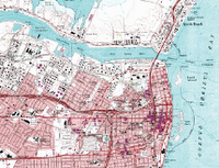
GPS is everywhere! More and more often customers are asking that their mobile handheld computer solutions included integrated GPS. Work orders, vehicle tracking, asset tracking, and route delivery projects now often require it. Recently on my trip to Australia, a company asked that their sales force automation project include GPS data capture. They want to make sure their sales staff are visiting their customers as reported.
Many companies want the added documentation that capturing a time/date stamp with a GPS coordinate gives them. They apply this to any work done at that location.
On engineering and construction projects - it is often requested that geological tests' (water, soil, compaction, etc) locations be captured with a GPS coordinate, to make re-testing easier.
On vehicle tracking projects - our customers often want to know the exact location of their vehicle (company asset) at any time. Why? So they can re-route the delivery truck when needed, optimize the route, or predict delivery times for customers. Sometimes, 2 delivery trucks need to meet up and exchange cargo. If the central database at the company office can see the location of all of their vehicles in real time, it makes it easier to have trucks meet up at convenient locations.
Using a RAD tool like MobileDataforce's PointSync, it is easy to capture a GPS location within any mobile application.


No comments:
Post a Comment